Edge
The cuckoos have gone. Two weeks ago, out at the Wash, they were calling from the shrubs surrounding the RSPB reserve, and further inland from the woodlands. Now, silence. Reed warblers and other small birds are busy raising huge cuckoo chicks, though.
There are two edges here. The first are the mudflats, those transient lands ‘between the salt water and the sea strand’, filled with birds; the second is the shingle beach, also but less obviously filled with life. The mudflats, actually silt-covered sand, are both mutable and immutable. Immutable, in that they have kept their basic shapes and properties for untold years, long enough to be both named and mapped; mutable, in that each tide reveals more or less of them, and each storm changes them slightly. Today at high tide the edges of Peter Black Sand are half a kilometer or more offshore, but with the right conditions of moonphase and water, high tide can lap the edges of the shingle. When this happens, the birds are pushed to the very edge in huge numbers, wheeling in huge clouds above the encroaching tide. But today they move slowly at the edge of the incoming water, only occasionally taking to the air.
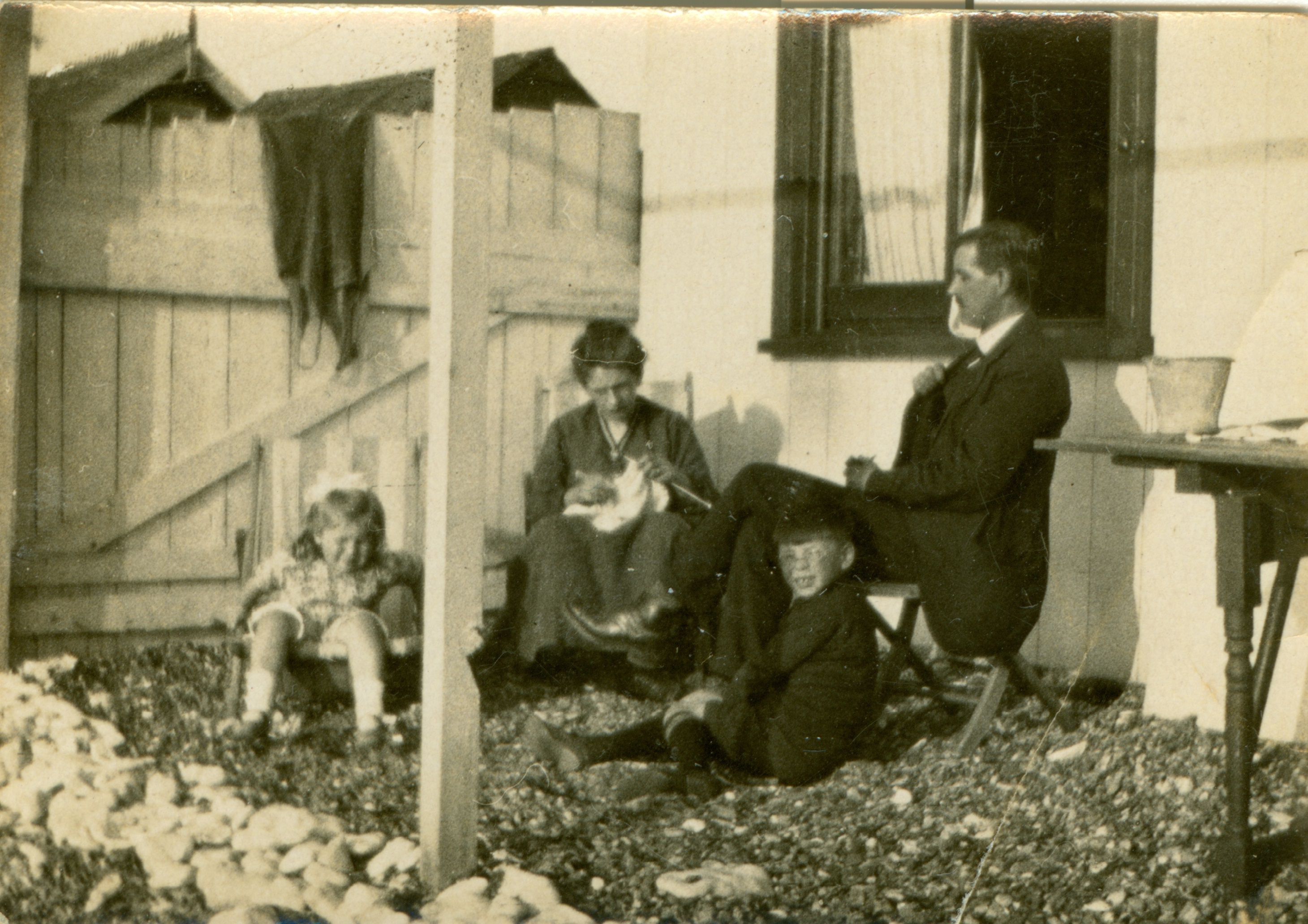
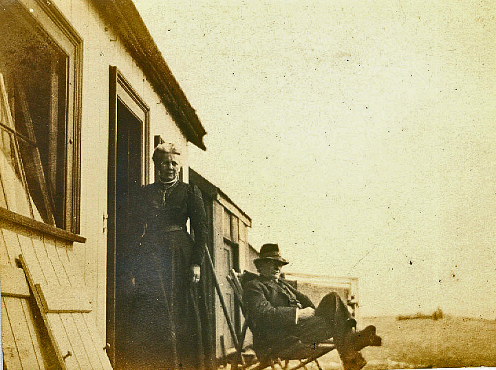
The shingle beach here is where my great-grandfather’s beach bungalow stood. Sunny Ridge, it was called, and was a modest single-story construction of wood, with no plumbing of any kind. It was probably not much more than a camp kitchen with (perhaps) room for a table and chairs, and I believe not meant for anything more than day use. All the photos show groups of adults and children outside the bungalow, the women often with handwork – knitting, needlework; the men in jacket and tie, even here, and the children sitting on the shingle.
My belief that the bungalows were meant for day use is furthered by my father’s recollections of a man, possibly called Bob, who did live in a shack on the shingle, making a living somehow from the sea and odd jobs.
Queen Alexandra had a bungalow here too, closer to where Beach Road meets the Wash, from 1908 to 1925 (although it was, of course, rather posher). Built of the local red carrstone, a form of sandstone, she would frequently come out in the summer, sometimes with guests. On occasion she would be driven down the beach in her pony trap. One warm spring day she stopped to greet my great-grandfather and several of his sons & sons-in-law (most known to her as Sandrigham servants) who were busy creosoting Sunny Ridge, in shirt-sleeves and with filthy hands. The rest of this story is lost, all but the embarrassment (or amusement) that resulted.
During the second world war all the shingle huts were requisitioned by the military as housing, to support the RAF gunnery training camp situated there. At the same time, the shingle was mined to support the building of roads and runways, creating the pits that are now the ponds of the RSPB reserve. A jetty was built to load the shingle onto barges, which could access the outflow of the River Ingol at high tide. Seventy years and two massive floods later, the remains of the jetty still stand, providing nesting posts for black-headed gulls. What was left of Sunny Ridge, if anything, would have been washed away in the flood of 1953.

Now the shingle is quiet except for the screaming of gulls, the calls of waders, and the songs of small birds in the gorse. Oystercatchers and ringed plover nest on the beach, and the plant life is specialized and to some extent uncommon. While classified as shingle grassland, there are, apparently, twelve distinct plant communities, reflecting the height above high water mark and the composition of the shingle.
A sea-bank, or dyke, holds the Wash back from the arable fields to the east of it. Most of these embankments are on Faden’s 1797 map, and there are mentions in much older documents of sea-banks failing on the Dersingham marshes in medieval times. The shingle ecosystem exists between the Wash and the embankments, and to some extent on the side of the embankments facing the sea. In the flood of 2013, this whole area was under water. The rising sea destroyed one of the hides, moved another, and introduced salt water into the freshwater ponds. We walked the reserve only a few weeks after the flood: silt and debris covered the site and in some places was nearly to the top of the seawall. Less than two years later, there is almost no visible damage. The vegetation looks as it always has, in my memory.
There are no government plans to protect this coast any further, south of the village of Heacham. No higher sea-walls will be built: if it floods, it floods. (Landowners – mostly Sandringham and Ken Hill Estates – can choose to build privately funded embankments.) Saltmarshes are natural coastal protection, creating a buffer and a transition zone between the sea and the land. I may, one day, see the land between the village and the Wash return to saltmarsh, the haunt of waterfowl and curlew, the curls of the roddons below the soil echoed in the channels and ponds of a living marsh.
Did you miss the first two excerpts? Read them here.
